Geo-Hydrological Survey
Geo-Hydrological Survey
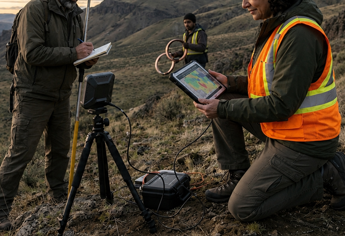
Assess site suitability and groundwater recharge potential through scientific analysis conducted by senior geologists using satellite-linked VLF technology
Key Benefits
-
 Accurate, data-driven site evaluation
 - Optimized design of recharge systems
- Reduced project risk and improved efficiency
- Supports sustainable water management solutions
Key Survey Components

Preliminary Site Assessment
Review of existing geological and hydrological data

Geological Mapping
Identification of soil layers, rock types, and subsurface formations

Hydrological Analysis
Study of rainfall patterns, surface water flow, and groundwater levels

Groundwater Quality Testing
Evaluation of water quality for safe and effective recharge

Aquifer Assessment
Analysis of porosity, permeability, and storage capacity

Soil Permeability Studies
Determines infiltration rate and suitability for recharge systems

Topographical Analysis
Identification of natural drainage patterns and ideal recharge zones

Recharge Potential Modeling
Simulation-based estimation of groundwater recharge capacity

Regulatory Compliance
Ensures adherence to all local and national guidelines
Photos & videos
furaat: L&T Project Geohydrological Survey
Furaat: Geohydrological test for rainwater recharge
Let's Work Together to Save Rainwater
Get in touch with us for customized rainwater harvesting solutions